The Best Atlas for You
People frequently ask, “Which atlas or map should I use?” This is a very personal choice and is therefore difficult to answer. Rather than suggest one specific atlas, I would like to present some options for your consideration as you choose the best atlas for you. Aside from any preexisting preferences the teacher might have, the type of students and the ways in which the maps will be used should also be taken into consideration. The terminology itself can be confusing so I will start by providing brief explanations. Some common terms used to describe atlases or maps include:
- compact atlas — smaller in size with little to no extra information
- concise atlas — similar to a reference atlas, but usually slightly smaller with maps of continents
- contour lines — curved lines drawn on a map to show elevation
- historical atlas — maps from previous eras, typically presented in chronological order
- ordnance map — official topographical map of an area in the United Kingdom originally designed to be used by the military
- reference atlas — large in size with a combination of maps of both continents and countries, along with a wealth of detailed extra information regarding aspects such as climatic, social, religious, and economic facts
- student atlas — less-detailed maps, with photographs and written blocks of information about the regions
- topographical map — shows the physical features of an area, frequently containing contour lines
Beginning Considerations for Narrowing Down Choices
Considering the age of the student who will be using the atlas is one place to start. Too much detail might overwhelm a younger child. The size of the font used for labels could also be a factor. Sometimes the distribution of the information on a map, rather than the amount of detail, affects how visually overwhelming it is. Older students should be able to study maps in more detail.
However, you might want to also consider the longevity and usefulness of any atlas or map you buy. Will you have the resources to purchase additional ones as your children get older? Do you want to be able to utilize the same atlases with both your older and younger children? In my experience younger children can be taught to read maps with quite a bit of detail.
It is always a good idea to take note of the publication date of any modern atlas you are considering. Depending on the year it was published, it is possible some of the information contained in it might not be up-to-date. Changes to the map of the world are still happening today. For example, as recently as 2019, Macedonia officially changed its name to North Macedonia. Outdated information is not necessarily a reason to rule out an atlas, but it is advisable to make note of any changes you will need to relay to your student.
Another element for consideration is whether the curriculum you are using recommends a particular atlas. If there are references to that atlas in the lesson plans, you might prefer to save yourself some work by utilizing their instructions. Charlotte Mason’s geography readers include maps to go along with her map questions. If you want to take advantage of using map questions written by someone other than yourself, you will probably want to use the specified atlas, or you will need to make sure relevant locations are included in the one you choose.
Purpose or Objective
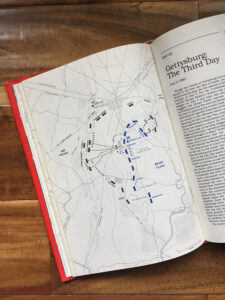
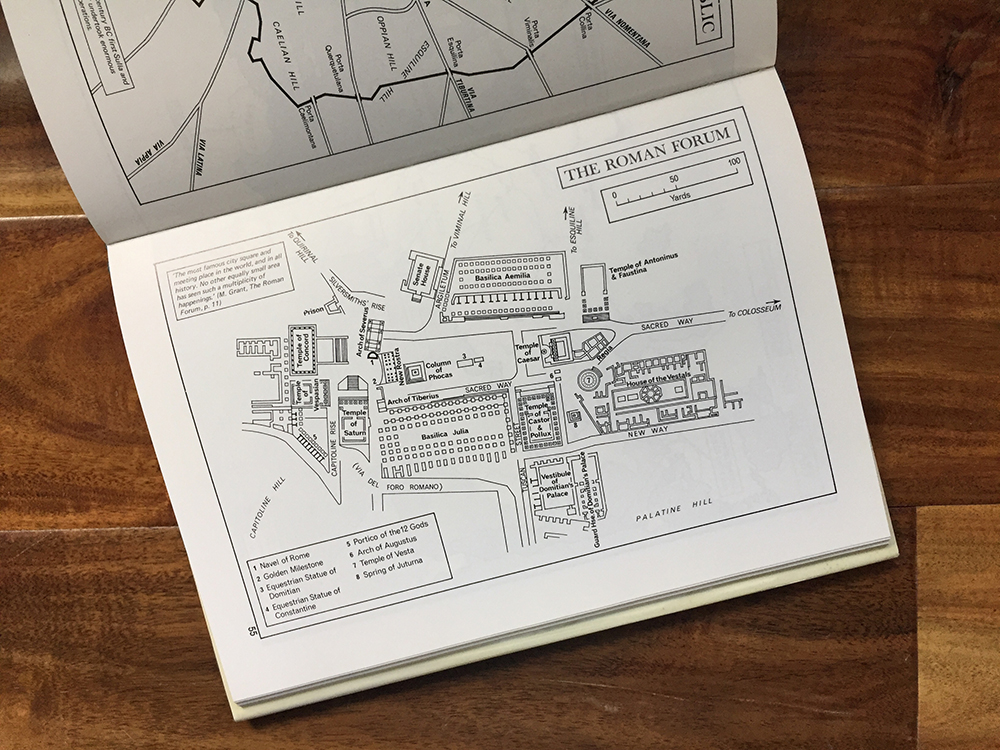
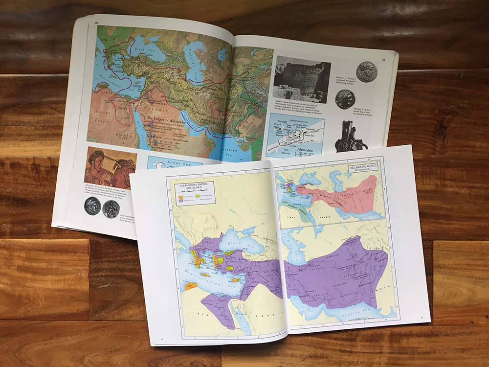
Your reason for using a map will have some bearing on the type of map you choose. Historical atlases can help us understand what we are reading in history books or Plutarch’s Lives. One such atlas concentrates on the ancient Greek and Roman world. There are even atlases with an extremely specific focus like battlefields of the Civil War. Bible atlases are another type of historical atlas. Others cover a longer span of time and larger geographic areas. Some show modern maps along with the historical ones.
Will you be needing to copy pages for a co-op or other classroom? Then you might prefer black and white outline maps instead of full color ones. A laminated map would allow for easy labeling. Teaching multiple students might necessitate a larger wall map. Start your search by reflecting on how you will be using maps in your home schoolroom or classroom.
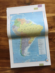
Continents or Countries and States
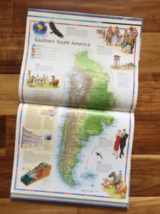
Will you be studying whole continents only? What about separate countries? If you are studying the United States or Canada will you be looking at each state or province individually, or in groups? An in-depth study of individual states might be better served by purchasing an atlas of the United States rather than a world atlas.
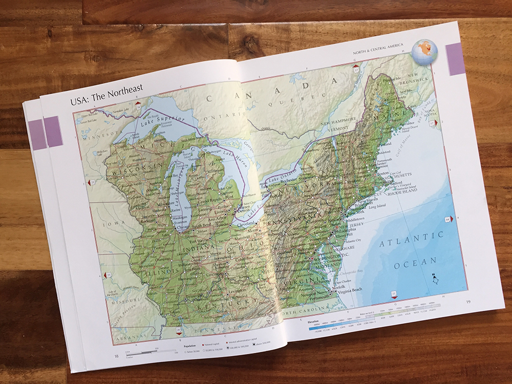
Level of Detail
PNEU students were encouraged to locate the lines of latitude and longitude within which countries or continents lay:
Following in their own atlases, the children found the countries it had included and its boundaries; then the parallels of latitude and the parts of other continents that lay between the same. From this and from a consideration of the position and direction of the “Andes” they deduced a few facts about the climate—at this point I read from “Pole to Pole” a short descriptive passage of the characteristics of the scenery. (Frost, 1915)
Unfortunately, not all maps include these lines. I have found many student atlases to be lacking in enough detail for my purposes.
Some maps designate a city or town by a dot of varying size. Others show the area of urban sprawl. There are many other details which may be included or omitted, such as interstates and other roads, national parks or forests, reservations, military bases, or national monuments.
The level of detail you desire will probably be based on the age of your student, elements you want them to study, and readability of the maps.
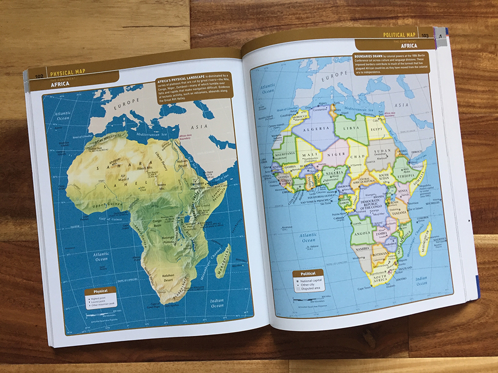
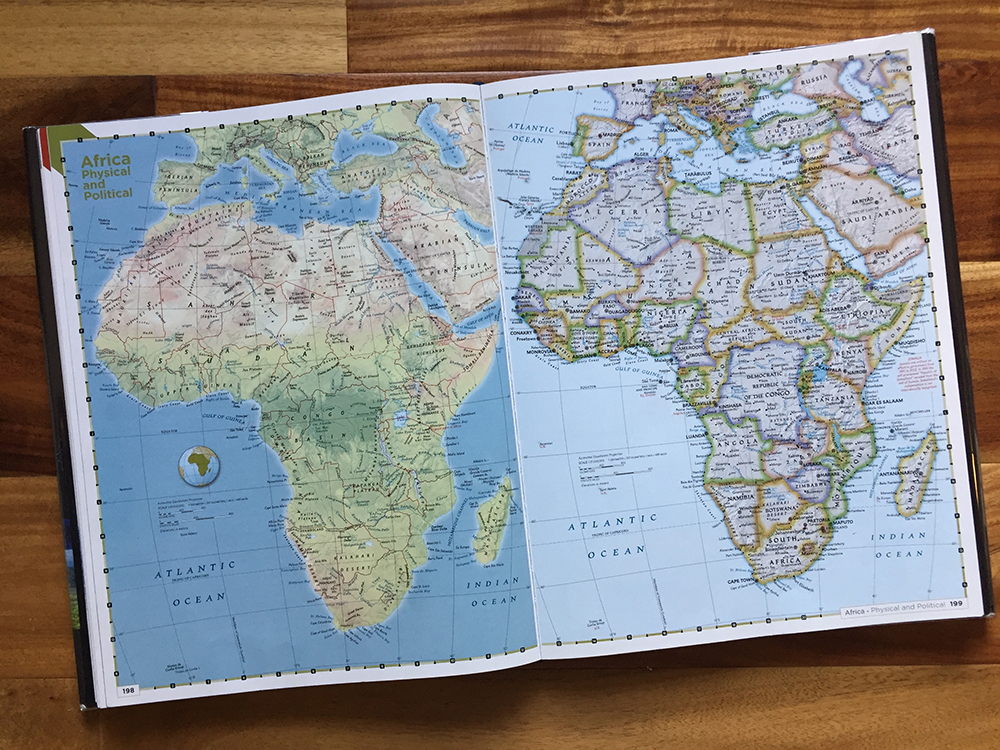
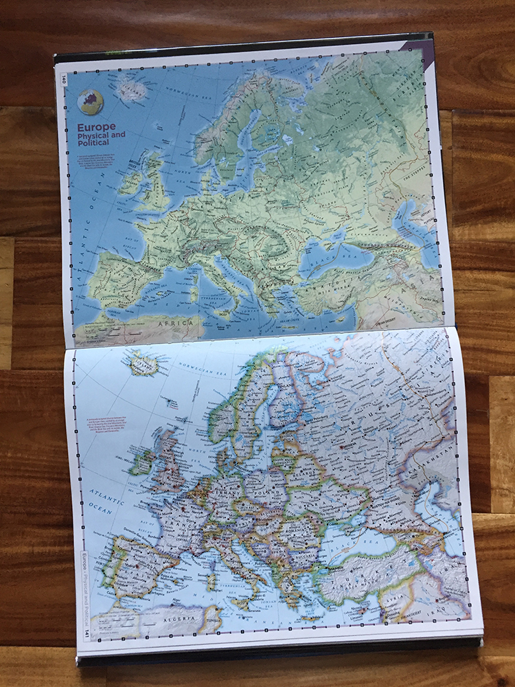
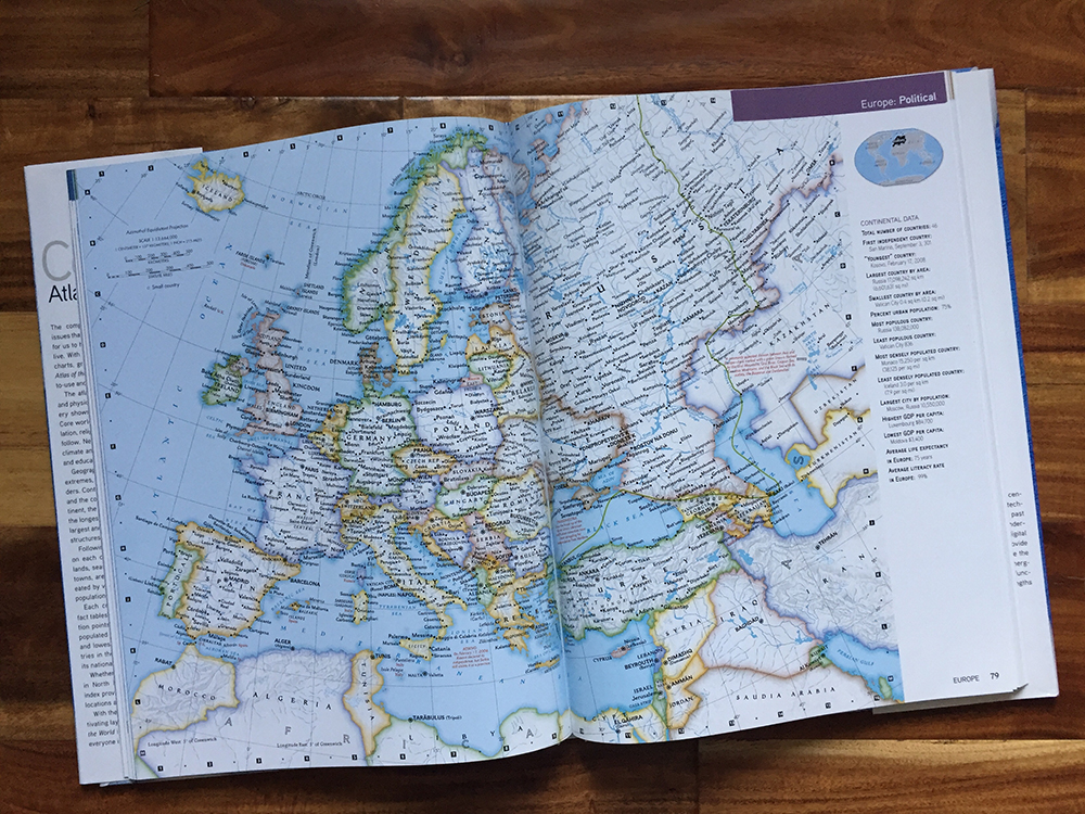
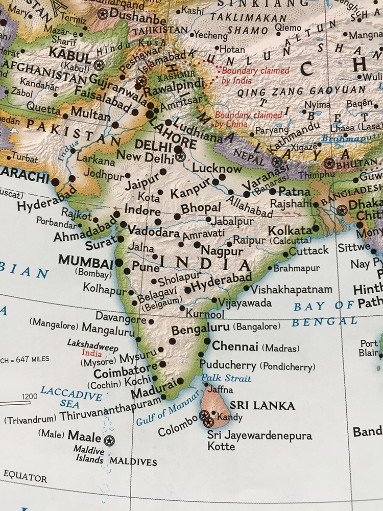
Political Versus Physical Maps
Maps tend to emphasize either political or physical features or combine the two. It may be helpful to define what a political map is:
Political maps are widely used reference maps that show governmental and geographic boundaries between units such as countries, counties, states, provinces, or regions. They may also show major cities, towns, and settlements depending on the purpose or use. In short, political maps indicate political features of a given place, including political boundaries…
Although political maps do not show topographic features, they may indicate certain physical elements, including drainage features such as lakes, rivers, and oceans, and mountains. These physical features on a political map are only used as geographical references. Besides physical features, political maps may also contain transportation networks like roads and rail. (Misachi, 2021)
These maps show a limited number of physical features. Many historical atlases and student atlases contain these kinds of maps.
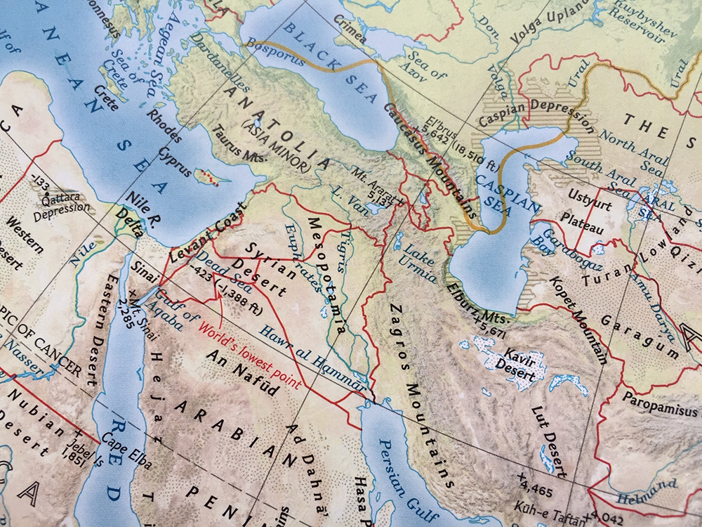
Physical maps, on the other hand, illustrate features we can see:
A physical map shows the Earth’s identifiable natural landscape features, including drainage features, relief, and topographic features. The maps are best known to illustrate the physical features either by shaded relief or colors. Physical maps also illustrate some essential political boundaries, such as country or state boundaries. However, this information is not the major focus; it is only included as a geographic reference.
Physical maps provide information about relief or topography or the shape, depth, and height of the natural features. These physical features include deserts, mountains, water bodies, and other identifiable landforms. Cartographers often use different colors and color hues to represent the various physical features on a map. Most maps have brown, green, or gray color schemes for showing gradient relief. The dark green color is often used to indicate elevations that are mostly near sea level, with the color transitioning into tan and brown as elevation increases. Gray often represents the highest elevation. (Misachi, 2021)
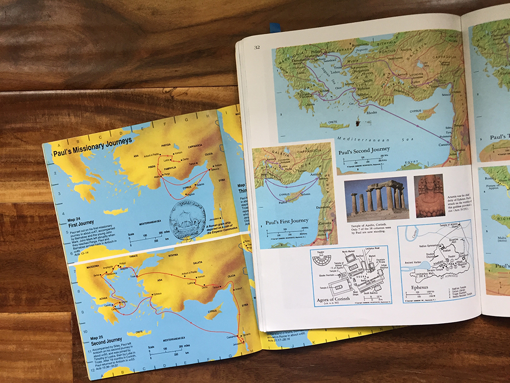
Personally, I think maps which include both political and physical features make it easier for a child to imagine what it would be like to be someone traveling or living in the area. Which of these two maps do you think more effectively encourages someone to picture what it would have been like to travel with Paul and Barnabas?
Do you prefer political and physical features to be overlaid on the same map or on separate maps? If separate, should they be on the same page? In order to view both maps at the same time, the size or detail of the map may be sacrificed.
Topographical maps are extremely comprehensive maps of specific areas. As they include many details, such as contour lines, land survey information, trails, power lines, railroads, and names of summits, they can be challenging for the average person to read. The article “How to Read Topographic Maps” provides instruction in developing this skill. This type of map illustrates changes in elevation and the shape of the land in more detail and is most useful to someone walking in mountainous terrain:
The height and shape of the land is shown on a map using ‘contour lines’… A contour line is drawn between points of equal height, so any single contour line will be at the same height all the way along its length… The closer together the contour lines, the steeper the slope of the hill. (Ordnance Survey, 2016)
Names and Labels
Names can change over time. Atlases which include historical names can help make connections between books you are reading and current maps.
Sometimes English-speaking people use an alternate name to refer to a place than the people local to that region. Do you prefer anglicized names or native names? Some atlases include both. One that we own uses the former on continent maps and the latter on maps of individual countries or regions.
The size and type of font used to label locations may be a concern for you. Is the font large enough for your student to read? Is it easy to distinguish between names of cities and physical features like rivers?
Additional Maps or Information
B. D. Parkin, in his Parents’ Review article “The Teaching of Geography,” recommends different kinds of maps to be used with the P.U.S. scheme of geography:
(a) World map for Newspaper Geography.
(b) World map for World Geography, e.g., The Volcano Line of Madam How.
(c) World map—Ocean Trade Routes.
(d) Home Geography—Local map.
(e) North England—Physical and Railways.
(f) North England—Rainfall.
(g) North England—The Lake District.
(h) North England—The Factory Towns.
…
(k) Alpine Passes and Communications.
(l) Italy—Physical and Communications. (Parkin, 1929)
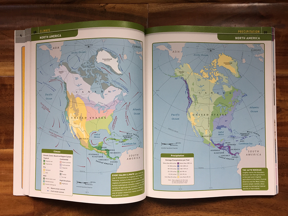
The possibilities are almost endless when it comes to maps. Some choices of maps depicting other information relevant to your geography studies include natural resources, climate, precipitation, industries, population, economies, geology, biomes, languages, religions, etc.
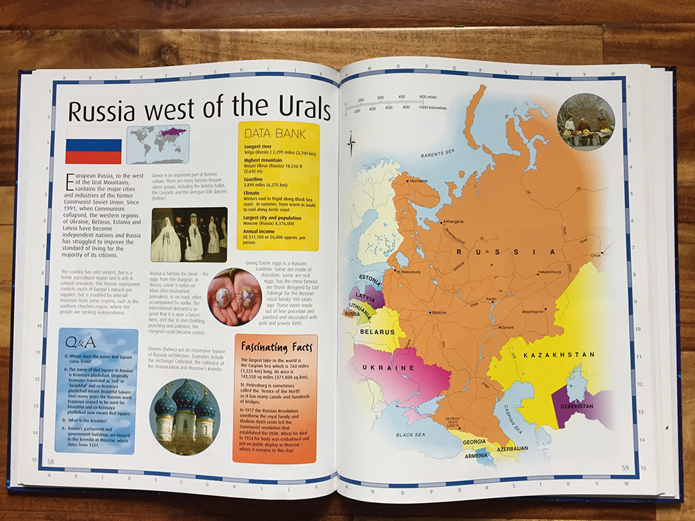
Mason’s geography readers contain descriptions about the land, history, and people in the various continents and regions around the world. Depending on the type of atlas, some of the same type of information may be included.
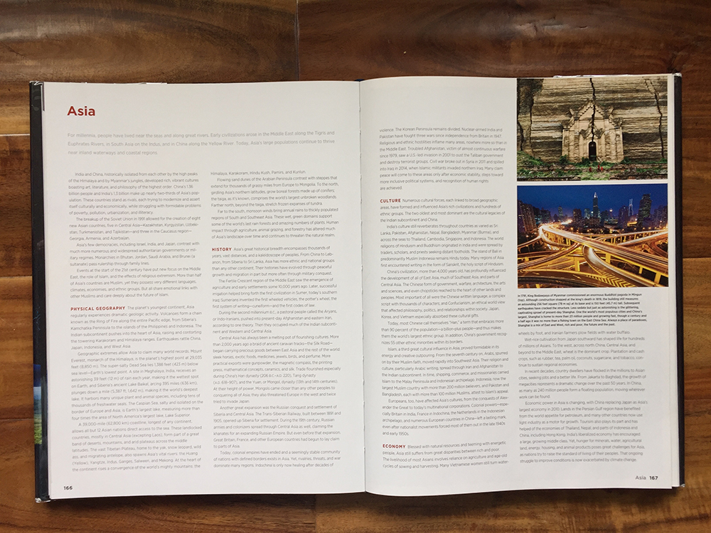
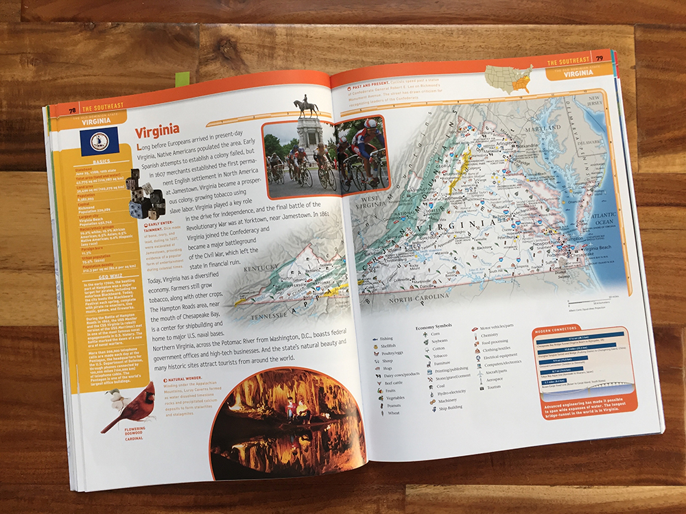
Atlases for children tend to include extra blocks of text regarding how people live in an area and what visitors might see. Photographs are often used for illustration.
Making a Final Decision
Now that you have narrowed down the alternatives, you can start shopping. You may not find the perfect atlas containing all your specifications, so prioritizing is helpful. Shopping online can be frustrating because many previews do not include any pages of the maps themselves. One way around this is by visiting a brick-and-mortar bookstore to browse through their atlases in person. Sometimes other parents or teachers are willing to share photos of atlases they own upon request. In any event, I hope the information contained in this article will alleviate some confusion and uncertainty in purchasing maps and atlases to use with your students. If you are like me, you may just end up purchasing multiple atlases.
References
Frost, E. (1915). Impressions of conference work with class II. In The Parents’ Review, volume 26 (pp. 573–578). London: Parents’ National Educational Union.
Misachi, J., (2021, April 28). Political and Physical Map. World Atlas. https://www.worldatlas.com/aatlas/infopage/political.htm
Ordnance Survey. (2016). Ordnance Survey map reading: from the beginner to the advanced map reader. Ordnance Survey. https://www.ordnancesurvey.co.uk/documents/resources/map-reading.pdf
Parkin, B. (1929). The Teaching of Geography. In The Parents’ Review, volume 40 (pp. 381–388). London: Parents’ National Educational Union.
Dawn Tull has been homeschooling her children using Charlotte Mason’s methods since 2009. Although earning an MS in Business Management has left her underqualified to manage her own household, she has slowly been accepting the fact her four children were born unique persons. After relocating their family numerous times, she and her husband Donnie, currently live near Knoxville, TN in the foothills of the Great Smoky Mountains. Researching and pursuing the truth is important to her and has given her a heart for supporting and encouraging other homeschool families. She enjoys studying and discussing Miss Mason’s philosophy with a local study group and taking advantage of the outdoors with a natural history club.
©2021 Dawn Tull
Subscribe: Apple Podcasts | Spotify | Amazon Music
6 Replies to “The Best Atlas for You”
Great and helpful article! Any way to get a list of the titles of the Atlases shown in the post? Thank you and God bless!
Yes, here is a list of the atlases pictured in this article:
Purpose or Objective: Image 1 – A Battlefield Atlas of the Civil War by Craig L. Symonds, Second edition, The Nautical and Aviation Publishing Company of America; Image 2 – Michael Grant’s Atlas of Classical History, Fifth edition, Oxford University Press
Continents or Countries and States: Image 1 – The Children’s World Atlas (Dr. Colin Arrowsmith, Cartographic Consultant), 2007 edition, Barnes and Noble; Images 2 and 3 – Compact World Atlas, Seventh edition, DK: Penguin Random House; Image 4 – Kid’s United States Atlas, Fifth edition, National Geographic
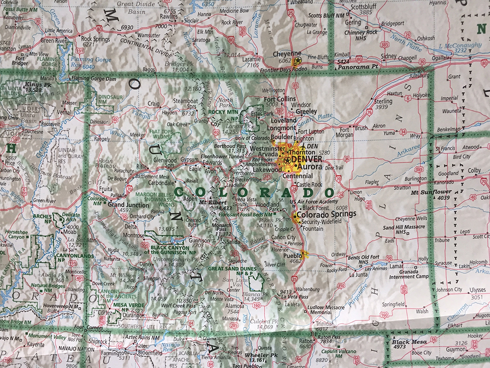
Level of Detail: Image 1 –Student World Atlas, Fourth edition, National Geographic; Image 2 – Family Reference Atlas of the World, Fourth edition, National Geographic; Image 3 – USA wall map, Imus Geographics
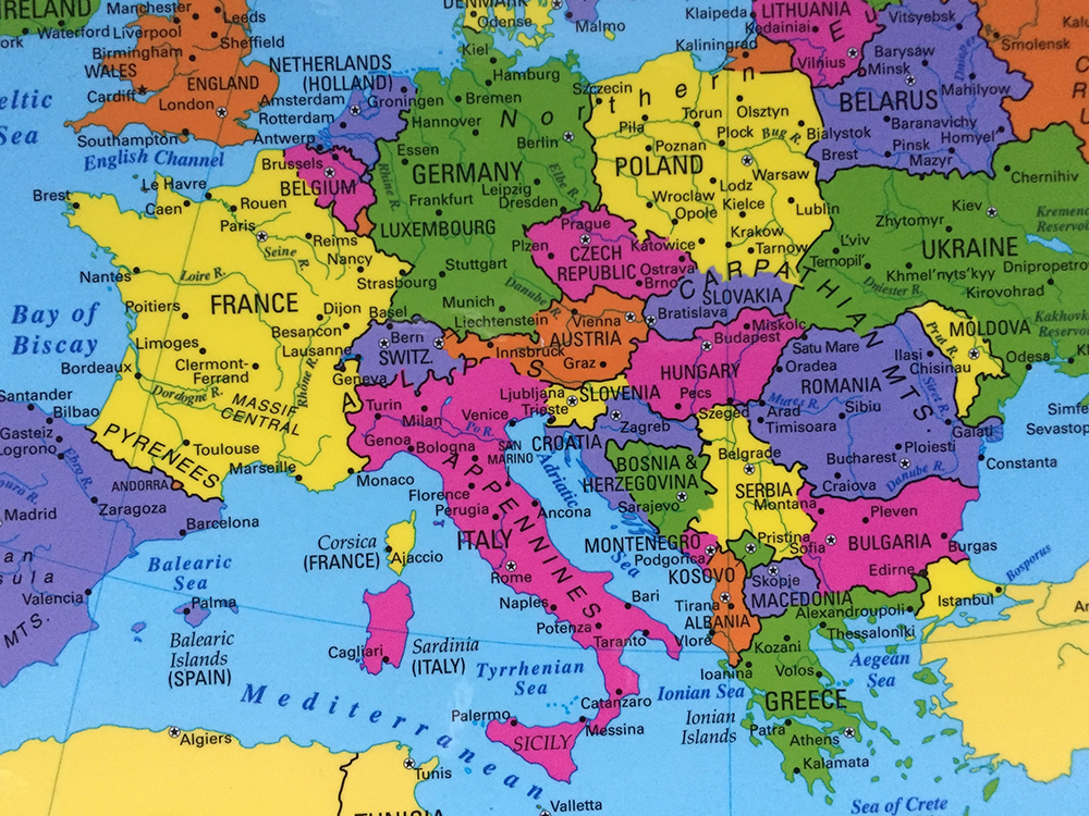
Political Versus Physical Maps: Image 1 – Europe placemat, Painless Learning Placemats; Image 2 – Atlas of the Bible Lands (Harry Thomas Frank, Editor), 1990 edition, Hammond Incorporated (top) and Historical Atlas of the World, Sixth edition, Rand McNally (bottom); Image 3 – The Student Bible Atlas by Tim Dowley, First North American edition, Augsberg (left) and Atlas of the Bible Lands (Harry Thomas Frank, Editor), 1990 edition, Hammond Incorporated (right); Image 4 – Family Reference Atlas of the World, Fourth edition, National Geographic; Image 5 – Concise Atlas of the World, Third edition, National Geographic
Names and Labels: Image 1 – Family Reference Atlas of the World, Fourth edition, National Geographic; Image 2 – Family Reference Atlas of the World, Fourth edition, National Geographic
Additional Maps or Information: Image 1 – Student World Atlas, Fourth edition, National Geographic; Image 2 – Family Reference Atlas of the World, Fourth edition, National Geographic; Image 3 – Children’s World Atlas, 2011 edition, Igloo
Regards,
Dawn
I’d be glad to see a list of the atlases of each type that you especially love. (And yay for Imus! He does such a great job. I love my Imus map.)
I first became aware of Imus because of you! Can you clarify what you mean by “each type”?
I’d also like to know, if possible, what sources (perhaps online) you have found to be best for blank maps for students to fill in. Or if you prefer a product like MapTrek.
I must confess, I haven’t recently researched those type of resources. It is quite possible there are other similar or better ones out there, but I’ll share some of my favorites we have used over the years for labeling and drawing routes on. The larger laminated maps from Geography Matters (https://geomatters.com/products/continents-map-set) are nice for hanging on the wall and writing on. The “Painless Learning Placemats” (like the one pictured in the article) have black and white blank maps on the reverse side. They are easy to pull out quickly and travel well for road trips. For printing paper copies I usually use Uncle Josh’s Outline Maps (https://www.rainbowresource.com/product/003136/Uncle-Joshs-Outline-Map-Book.html?). This link is for the book which you would copy, but includes some views of some pages. You can also purchase a CD with the pdfs. While we do occasionally label blank maps, the majority of labeling we do is on sketch maps that my children draw themselves. I’m not a fan of Map Trek as I find the maps too simplistic with little to no physical features included.